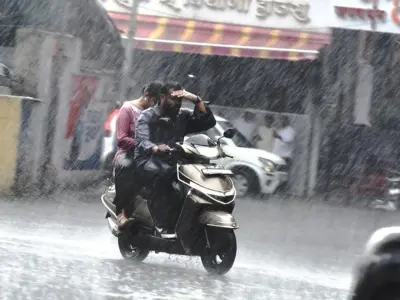

As monsoon clouds gather over Delhi, a familiar anxiety returns for thousands living along the Yamuna's banks. This year, the Delhi government says it is better prepared. Officials have identified eight specific hotspots along the river where flooding is most likely, marking a shift from general alerts to targeted, location-specific monitoring.
Eight locations under watch: What the government's flood plan means
The decision to pinpoint eight vulnerable stretches along the Yamuna is a significant operational change. Instead of a blanket warning for the entire riverfront, authorities will now concentrate resources—monitoring teams, pumps, and evacuation plans—on these high-risk zones. This allows for faster, more precise response when water levels rise.
Why this matters: The human cost of Yamuna floods
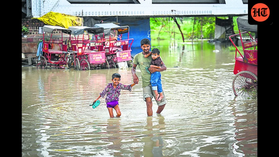
For residents of low-lying colonies like those near the Yamuna Bazar, Usmanpur, and the Boat Club area, floods are not a distant news story. They are a recurring reality that means lost homes, damaged belongings, and disrupted lives. In 2023, the Yamuna swelled to a record 208.66 metres, inundating vast areas and forcing the evacuation of over 10,000 people. The new hotspot identification is a direct response to that crisis, aiming to prevent a repeat of the chaos and suffering.
From crisis to preparedness: How the 2023 floods changed Delhi's approach
The devastating floods of July 2023 exposed critical gaps in Delhi's flood management. The sudden release of water from the Hathnikund Barrage in Haryana, combined with heavy rainfall, caught many unprepared. The aftermath saw a political blame game and a scramble for relief. The current initiative to identify eight hotspots is a tangible outcome of that experience—a move from reactive crisis management to proactive, data-driven monitoring.
Who is most at risk? The communities on the front line
The eight identified hotspots are not just geographical coordinates; they are home to some of Delhi's most vulnerable communities. These include residents of unauthorised colonies, slum clusters, and areas near the riverbed. Many are daily-wage labourers, small shopkeepers, and families who cannot afford to move to safer areas. For them, the government's monitoring plan is a lifeline—but only if it translates into timely warnings and effective evacuation support.
What the government has said so far
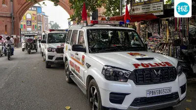
While the Delhi government has confirmed the identification of the eight hotspots, it has not yet released the full list of locations or the detailed monitoring protocol. Officials have indicated that the plan involves deploying teams from the Delhi Irrigation and Flood Control Department, the Delhi Police, and the Disaster Management Authority. The focus will be on real-time water level monitoring, pre-positioning of rescue equipment, and community awareness drives.
Beyond the hotspots: What this monitoring system actually involves
The new approach is expected to include the installation of automated water level sensors at the eight locations, linked to a central control room. This would provide real-time data on rising water levels, allowing authorities to issue targeted alerts to specific areas. In addition, the government plans to conduct regular drills and mock evacuation exercises in these zones. The goal is to reduce the reaction time from hours to minutes.
Confirmed facts vs what remains unclear
Confirmed: The Delhi government has identified eight vulnerable locations along the Yamuna for monsoon flood monitoring. This is part of a broader flood management strategy. Unclear: The exact names of the eight hotspots have not been officially released. The specific monitoring technology and protocols are yet to be detailed. The timeline for full implementation is not publicly known. This article is based on official statements and credible news reports; any speculation is clearly labelled.
How Delhi compares: Flood monitoring in other Indian cities
Delhi is not alone in facing riverine flood risks. Cities like Mumbai, Chennai, and Patna have also developed hotspot-based monitoring systems. Mumbai, for instance, uses a network of rain gauges and water level sensors to track flooding in low-lying areas. Delhi's move aligns with a broader trend in urban flood management—moving from general warnings to hyperlocal, data-driven response. The success of this approach will depend on the accuracy of the monitoring and the speed of the response.
What residents should do now: Practical steps for those in flood-prone areas
If you live near the Yamuna, especially in areas that have flooded before, here are some steps to consider: Stay tuned to local news and official alerts from the Delhi Disaster Management Authority. Keep an emergency kit ready with documents, medicines, and essentials. Identify the nearest evacuation centre and safe route. Report any unusual rise in water levels to the local control room. Do not wait for a formal evacuation order if you feel unsafe—move to higher ground early.
What happens next: The monsoon forecast and Delhi's readiness
The India Meteorological Department (IMD) has predicted a normal monsoon this year, but localised heavy rainfall events remain a risk. The Delhi government's ability to effectively monitor the eight hotspots will be tested in the coming weeks. The success of this initiative will depend on coordination between multiple agencies, the reliability of monitoring equipment, and the cooperation of local communities. If executed well, it could set a new standard for flood management in the capital.
Our Take
The identification of eight Yamuna flood hotspots is a welcome step towards smarter, more humane disaster management. It acknowledges that floods are not just a natural phenomenon but a recurring crisis that disproportionately affects the poor. However, a list of locations is only as good as the action it triggers. The real test will be in the execution—whether the monitoring translates into timely warnings, effective evacuations, and, ultimately, saved lives. Delhi cannot afford another 2023.
Frequently Asked Questions
Which are the eight flood hotspots identified by the Delhi government?
The Delhi government has confirmed the identification of eight vulnerable locations along the Yamuna for monsoon flood monitoring, but the full list of specific areas has not been officially released. Past flood-prone zones include areas near Yamuna Bazar, Usmanpur, the Boat Club, and low-lying colonies.
Why did the Delhi government identify these specific hotspots?
The identification follows the devastating 2023 Yamuna floods, which exposed gaps in preparedness. By focusing on high-risk zones, the government aims to improve early warning, faster response, and better resource allocation during the monsoon season.
How will the flood monitoring system work at these hotspots?
The plan involves real-time water level monitoring using sensors, pre-positioning of rescue equipment, regular drills, and coordination between the Irrigation and Flood Control Department, Delhi Police, and Disaster Management Authority. Targeted alerts will be issued to specific areas.
What should residents in flood-prone areas do to stay safe this monsoon?
Residents should stay updated on official alerts, prepare an emergency kit with documents and medicines, identify the nearest evacuation centre, and report any unusual water level rise to authorities. Early evacuation is advised if conditions worsen.