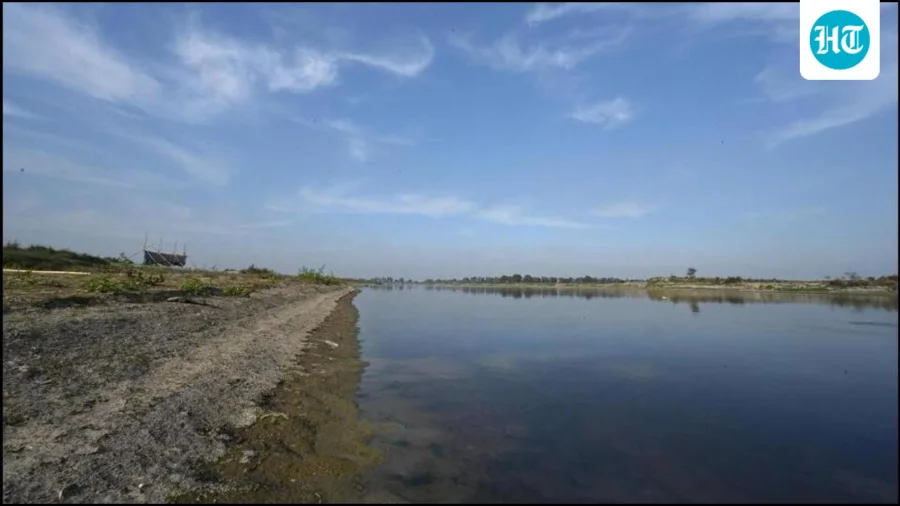
For most Delhi residents, the Yamuna is something they cross, not something they see. Now the city wants to look beneath it — all 48 kilometres of it, from Palla in the north to Jaitpur in the south.
The Delhi government has decided to carry out topographic and underwater bathymetric surveys of this entire stretch, with one clear objective: map the riverbed and find out which sections are clogged.
What Exactly Is Being Surveyed — and How
Two different surveys are being planned, and they answer two different questions.
The topographic survey reads the surface — the land terrain and the shape of the river's edges and floodplain. The bathymetric survey reads what lies underwater, measuring the depth and profile of the riverbed itself.
Put together, they produce something Delhi has not had in usable form: a detailed picture of the river's actual floor, not just its visible surface.
Why a Clogged Riverbed Is a Delhi Problem, Not Just a River Problem
A riverbed that has silted up or been blocked does not hold or move water the way it should. That has consequences that reach well beyond the riverbank.
It affects how the river behaves during high-flow months, how the floodplain drains, and how the river's ecology functions. For a city that has repeatedly faced questions about the Yamuna's condition, knowing where the blockages are is the difference between guessing and acting.
Palla to Jaitpur: Why This Particular Stretch
Palla, on Delhi's northern edge, is where the Yamuna enters the capital. Jaitpur, in the south, is effectively where it leaves.
Surveying the full 48-km run — rather than isolated patches — means the findings can be read as one continuous profile. That matters, because a blockage in one segment often explains a problem in another.
Who This Affects — and Why It Matters to Them
The immediate beneficiaries are the agencies responsible for the river's upkeep, who will finally have a mapped baseline to work from.
But the stakes are wider. Residents of floodplain colonies, farmers along the stretch, and anyone who has watched the Yamuna's condition worsen over the years have a direct interest in whether this survey translates into action.
What Has Been Confirmed — and What Has Not
Confirmed: the decision to conduct both surveys across the 48-km Palla-to-Jaitpur stretch, and the stated purpose of mapping the riverbed and identifying clogged sections.
Not yet clear: which agency will execute the surveys, the timeline, the cost, and — most importantly — what will be done with the findings. Those details have not been specified in available information, and readers should treat them as open questions rather than settled plans.
The Gap Between Mapping and Fixing
A survey is a diagnostic tool. It does not, on its own, clear a single metre of silt.
The real test of this exercise will be whether the data it produces is followed by a funded, time-bound plan to address whatever it reveals. Mapping without follow-through has been a familiar pattern in urban river management across India.
Risks and the Balanced View
There are legitimate questions worth asking. Survey data can be technically sound and still sit unused. Bathymetric surveys in heavily silted, seasonally variable rivers are also complex, and results can shift with the water level at the time of measurement.
None of this makes the survey a bad idea. It makes it an incomplete one — a necessary first step whose value depends entirely on what comes next.
A Wider Shift in How Cities Read Their Rivers
Delhi's move fits a broader pattern: Indian cities increasingly turning to technical surveys — bathymetric, topographic, GIS-based — before committing to expensive river works.
It is a shift from reactive desilting to evidence-based planning. Whether it holds depends on how seriously the evidence is used.
What Readers Should Take Away
If you live along or near the Yamuna, this is a development worth tracking — but not yet one to celebrate. The survey is the beginning of a process, not the outcome of one.
Watch for three things: who is appointed to conduct it, how long it takes, and whether the findings are made public. Transparency at each stage will determine whether this becomes a genuine turning point or another report on a shelf.
Future Outlook
If executed and acted upon, the survey could give Delhi its first clear, data-backed picture of the Yamuna's riverbed — a foundation for desilting, flood management and ecological restoration.
If it stalls at the announcement stage, it will join a long list of well-intentioned plans for the river. The next few months will indicate which way this goes.
Our Take
This is a sensible, low-drama decision that deserves more attention than it will likely get. Mapping the Yamuna's floor is unglamorous work, but it is exactly the kind of groundwork that has been missing.
The honest caveat: Delhi does not have a great record of converting river studies into river results. This survey will be judged not by its announcement, but by whether the map it produces ever changes what happens on the ground.
Frequently Asked Questions
What is the Delhi Yamuna survey about?
It is a planned topographic and underwater bathymetric survey of the 48-km Yamuna stretch from Palla to Jaitpur, aimed at mapping the riverbed and identifying clogged sections.
What is a bathymetric survey?
A bathymetric survey measures the depth and physical profile of a waterbody's floor — essentially, it maps what lies underwater, the way a topographic survey maps land surface.
Why is the Yamuna being surveyed from Palla to Jaitpur?
Palla is where the Yamuna enters Delhi and Jaitpur is where it exits. Covering the full 48-km run allows the riverbed to be assessed as one continuous profile rather than in disconnected patches.
Will this survey clean up the Yamuna?
No. The survey is a diagnostic step — it identifies where problems are. Actual desilting, cleanup or restoration would require separate, follow-up action based on the findings.